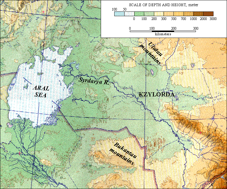
Hypsometric maps are topographic maps that shows elevations with color sequences that fill spaces between contours.
This Hypsometric map shows the elevations of Kzylorda using various color tones. In this hypsometric map, shades of green are used for lower elevations, shades of yellow or tan for medium elevations, and reds and/or browns for higher elevations.
In this example, the sea is about 50 meters below sea level as indicated by the scale. The highest mountain areas are dark brown and are about 3000 meters.
http://lu.com/odlis/odlis_h.cfm
No comments:
Post a Comment