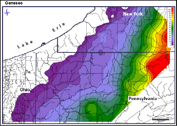
 An Isopach map consists of lines connecting places of equal value (thickness) for a given theme such as rainfall or temperature.
This map shows the thickness in feet of shale deposition along the Appalachian Basin. The purple area is a thinner area and the red is the thickest.
http://www.searchanddiscovery.net/documents/2007/07022lash/index.htm
No comments:
Post a Comment